Joseph Pearce, Lead Geospatial Specialist – Geodesy and PNT, UKHO, shares insights from onboard the first leg of the ‘CSM2026’ survey – a collaborative seabed mapping survey, coordinated by the UK Centre for Seabed Mapping (UK CSM). Taking place off the south-west coast of the UK, this survey saw 11 organisations collaborate to gather data and insights to improve understanding of the seabed.
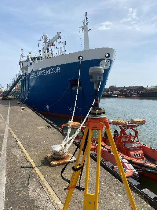
In the early hours of Monday 20 April, the Research Vessel Cefas Endeavour reached its survey area off the Cornwall coastline, having departed from Lowestoft. Over the following two weeks, a team of marine scientists and experts collected seabed mapping data that will go on to support a range of activities – from safer navigation to environmental research.
The team had a shared goal of collecting high-quality seabed mapping data to support a wide range of needs, with the ethos of “collect once and use many times”.
- In just two weeks, the team mapped an area of seabed around six times the size of the city of Southampton.
- This is the first time this particular Marine Protected Area has been surveyed to modern standards using up-to-date equipment.
- The team collected more data than planned, which allowed the survey to cover additional areas.
- The survey identified several wrecks for further investigation, supporting safer navigation in the area.
Building the picture of the seabed
In the days leading up to departure, teams from the participating organisations mobilised in Lowestoft to install, configure and test the survey equipment. UKHO surveyors carried out detailed cleansing and validation work to ensure systems were set up correctly and data could be captured to the highest possible standard from the outset.
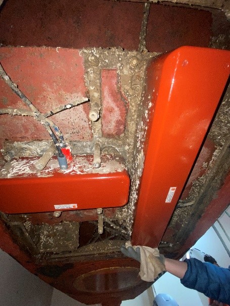
Once the vessel reached the survey area, the team in the survey suite began calibrating onboard systems. Surveyors carried out repeatability, or ‘patch’, tests to confirm the equipment was measuring data accurately and consistently. One way to do this is by surveying known wrecks, allowing the team to compare new readings with existing data and validate the results.
With the equipment calibrated and validated, the team could then begin the main survey work.
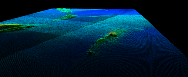
Using equipment such as multibeam echosounders and sub-bottom profilers, experts spent the first two weeks of the survey building a comprehensive picture of the seabed in this area.
In simplified terms, the multibeam echosounder used sends out pulses in a fan shape and measures how long they take to return. Gradually, a three-dimensional image depicting the depth and shape of the seabed then emerges – this is known as bathymetry.
During the first few days of the survey, the teams identified several features including:
- The wreck of an unknown steamship
- A large rocky feature, approximately 700 meters long, similar to formations found on Bodmin Moor and Dartmoor
- The wreck of the submarine HMS M1 (which sank in 1925 and was discovered in 1999)
The seabed mapping data collected during the survey underpins almost all marine activity. It helps ensure safer navigation, supports environmental protection, and informs smarter decisions about how we use and manage our seas.
For some of the wrecks in this area, this was the first time they had been surveyed using modern techniques. Earlier surveys relied on older equipment and divers, providing a much less complete picture of the seabed.
The rocky features were of particular interest to scientists from the Maritime and Coastguard Agency (MCA), Centre for Environment, Fisheries and Aquaculture Science (Cefas) and the British Geological Survey (BGS). They offered new opportunities to learn more about seabed habitats and how these features relate to familiar landscapes.
Collect once, use many times
By bringing together organisations from across government, CSM2026 is designed to make the best possible use of shared resources. By collecting data once and analysing it together, teams can meet different needs at the same time.
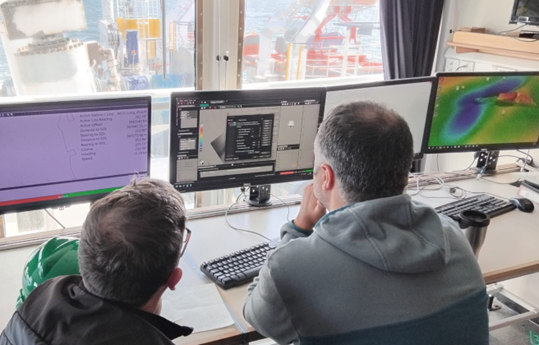
During the first survey leg, scientists and surveyors worked side by side, using shared data to support a range of activities.
This included collecting:
- Bathymetry – used to create navigational charts
- Backscatter – used to understand seabed for charts, geology and ecology
- Water column data – used to identify and investigate wrecks
This data supports a range of activities, including:
- Safe navigation - UKHO surveyors analysed seabed mapping data to create the data sets used to update navigational charts, supporting safe passage of vessels in the area and provide a foundational data set for the rest of the survey.
- Environment monitoring - Cefas scientists identified areas of potential environmental significance around features revealed in the data.
- Marine planning - Historic England scientists used backscatter data (a by-product of the multibeam survey) to identify potential wrecks and inform planning for marine heritage projects. BGS scientists combined this with sub-bottom profiler data to investigate geological features such as glacial moraines, buried riverbeds and larger rock formations.
This shared approach supports nautical charting, environmental research, geological analysis and operational planning – showing how collaborative surveying enables better, more joined‑up decisions about our seas.
Starting the second leg of CSM2026
On Monday 4 May, the vessel docked in Falmouth, marking the end of the first leg of the CSM2026 survey as scientists and surveyors disembarked. The following day, a new team of maritime experts from the participating organisations joined the vessel and began the second leg, transiting back to the survey area off the coast of Cornwall.
The data collected during the first leg shaped the work carried out during the second leg of the survey. It helped determine where to take seabed samples and where to deploy equipment to build a deeper understanding of the marine environment and habitats.
Over the course of the survey, teams onboard worked together to unlock new insights from the data collected – demonstrating the value of collecting once and using many times.
What's next?
With both survey legs now complete, teams are continuing to analyse the data and build on the foundations established during the survey. In the longer term, it will support a wide range of marine activities – from charting and navigation to environmental management and research.
CSM2026 demonstrates how a coordinated, cross-sector approach can deliver lasting value, with data used well beyond the life of the survey.
Leave a comment