Safe navigation relies on accurate hydrographic data, and collecting that data requires skilled surveyors, specialist equipment, and local expertise. For a remote island such as St Helena, located in the South Atlantic, having this capability locally is particularly important.
Through its longstanding partnership with St Helena Government, the UKHO has provided loaned survey equipment and practical training to local teams. This is helping St Helena to collect vital seabed mapping data and support the safe and secure supply of goods to the island community.
Why is supporting hydrographic capacity building important?
Hydrography is the science that measures and describes the physical features of the seabed. Accurate hydrographic data underpins safe navigation, environmental management, and sustainable use of the marine environment. However, collecting and maintaining that data requires specialist equipment, technical expertise, and the ability to undertake surveys on an ongoing basis.
For island nations such as St Helena, developing local hydrographic capability ensures the mariners on board vessels approaching the remote island have access to fit-for-purpose information and helps to maintain the safe and secure supply of essential food and goods for its community.
Hydrographic data also enables coastal states like St Helena to gain further insights into the marine environment. Seabed mapping data provides marine scientists with information on marine habitats, as well as supporting decision-making for environmental protection and management.
As a world leader in hydrography, the UKHO shares its expertise with the global hydrographic community and actively supports the UK Overseas Territories and other partners, to develop their hydrographic capabilities. In St Helena, the UKHO has provided access to specialist expertise, training, and state-of-the-art hydrographic survey equipment to undertake essential surveys within its port. By empowering local teams to collect, process, and manage hydrographic data themselves, the UKHO supports long-term resilience while improving the information used to update official navigational products.
Building capability through practical training
The capacity development has formed part of a longstanding partnership between the UKHO and St Helena Government, which aims to strengthen local hydrographic capability and support the collection of high-quality seabed mapping data around the island.
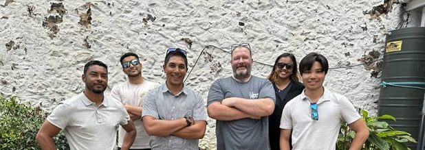
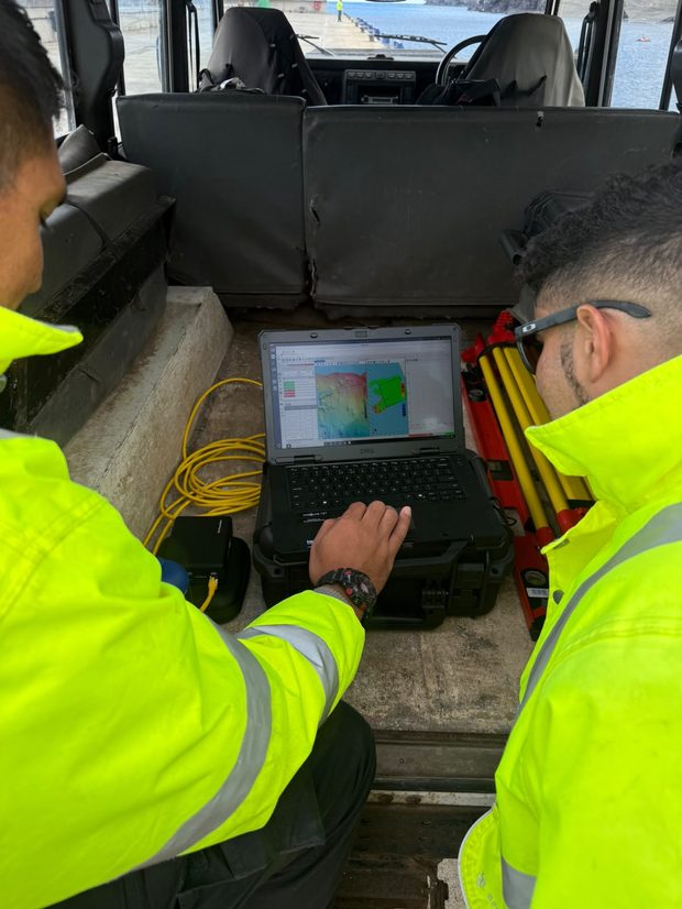
Following an introduction to hydrographic surveying and the systems involved, UKHO hydrographic experts spent two weeks working alongside marine stakeholders in St Helena. They shared practical surveying techniques and provided hands-on training in the use of the UKHO’s loaned survey equipment. Staff from St Helena’s Geographical Information Systems, Marine and Meteorological departments developed the skills needed to collect, process and manage seabed mapping data independently.
Using new technology in St Helena
Through its Hydrographic survey Equipment Loan Pool (HELP), the UKHO provided access to an uncrewed surface vessel (USV) equipped with an advanced multibeam echosounder. The all-in-one survey platform enabled the team to begin surveying the island's waters immediately. UKHO hydrographic experts then worked alongside local stakeholders, providing hands-on training and building the skills and confidence needed to operate the system safely in shallow and coastal waters around St Helena.
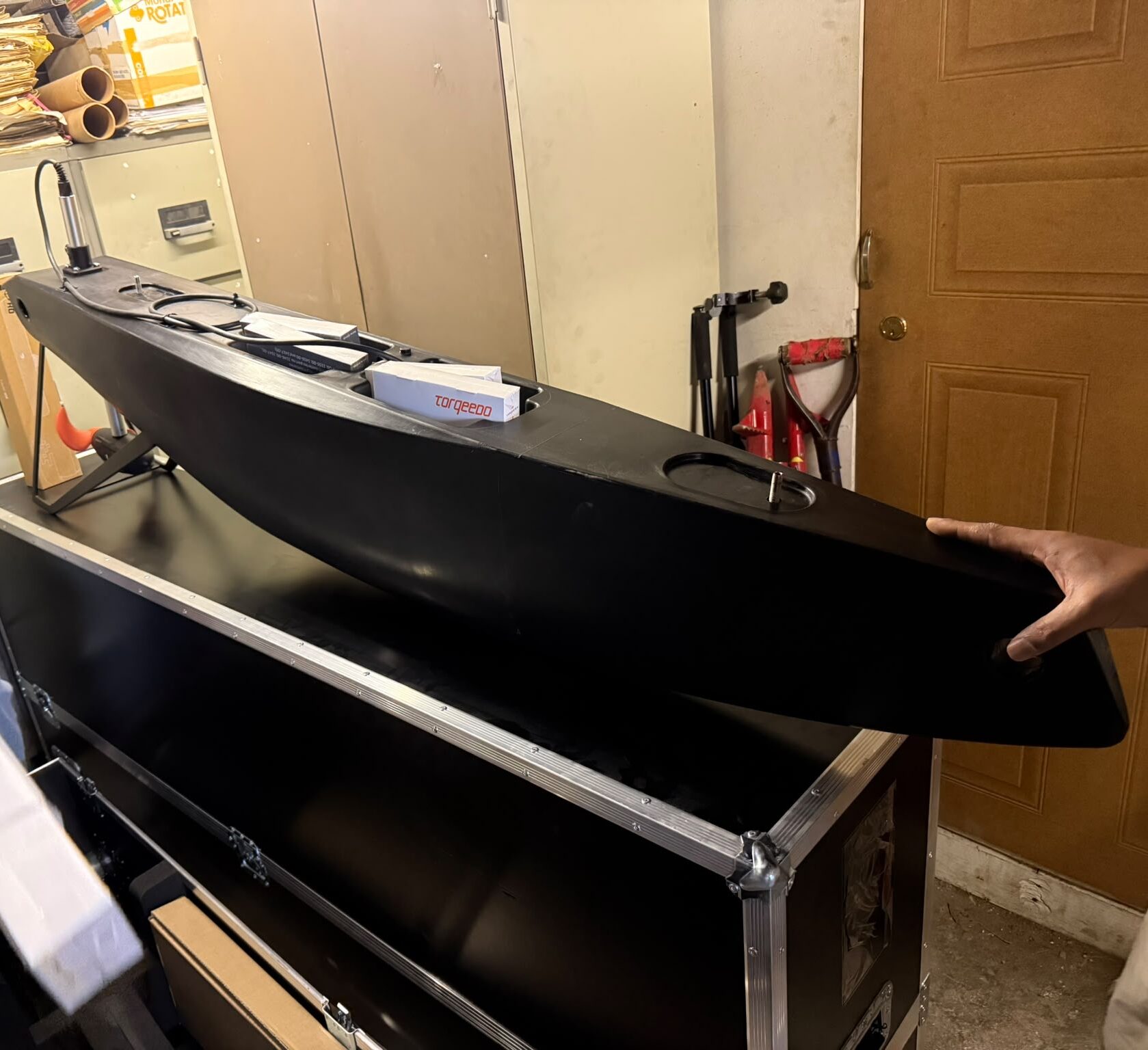
As well as supporting hydrographic surveys, USVs can be used in a range of operational situations, including search and rescue activities and environmental monitoring. This makes them a flexible tool for St Helena's marine community, while producing fewer emissions than traditional survey vessels.
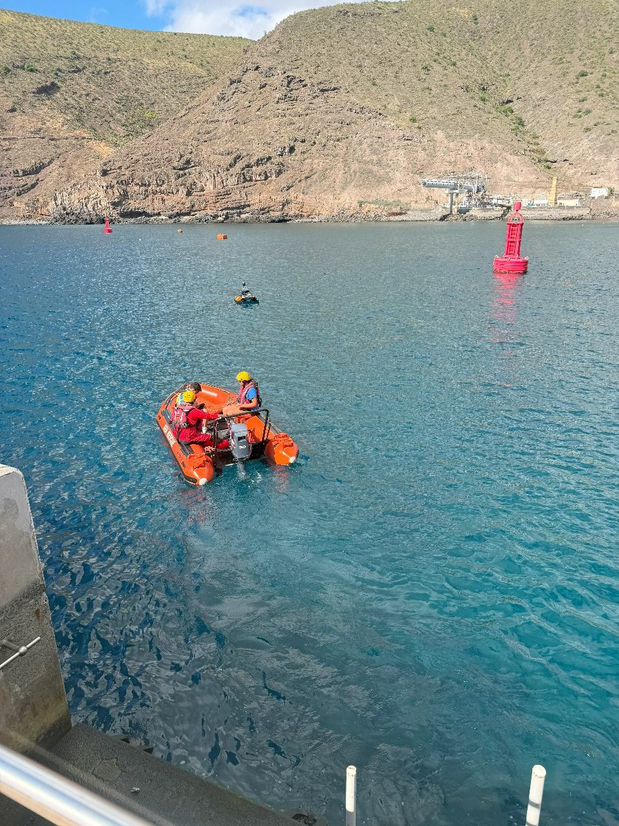
The initial training focused on using the USV to monitor the port environment and support the safe arrival of supply vessels. In the next phase, local teams will use the multibeam system on a local vessel to survey St Helena's coastal waters. Enabling local teams to use and maintain this technology is an important step towards building a sustainable hydrographic capability in St Helena.
Devlin Yon, Head of Geomatic Services, St Helena Government, commented on the importance of this type of international collaboration, noting that:
“By bringing together colleagues from across government and providing hands-on experience with modern survey technology, we are building the foundations for a sustainable, locally managed hydrographic programme.”
Kerrie Howard, PCA Programme Manager, UKHO said:
“I am delighted that St Helena Government is the first recipient of equipment through the UKHO’s Hydrographic Survey Equipment Loan Pool. This provides them with the skills and equipment they need to collect hydrographic data, supporting both St Helena’s SOLAS commitments and wider use across government. This initiative will provide them with invaluable data to understand, manage and protect their marine environment.”
What happens next?
This approach demonstrates the UKHO’s ongoing commitment to support its partners globally to strengthen their hydrographic capabilities. It also signals a change in how we support our partners, focusing on enabling and empowering our partners to develop their data collection capabilities.
The UKHO will continue to work with St Helena and its partners, to ensure the data collected meets international hydrographic standards (IHO S-44) and UKHO’s data requirements for producing trusted products and services. While St Helena was the first beneficiary of equipment from UKHO’s HELP, the pool is currently being expanded to support more UK Overseas Territories and UKHO partner nations. As a global leader, the UKHO is proud to support nations across the globe to provide access to equipment that may not otherwise be accessible and empower local hydrographers to undertake the surveys of their own waters.
Based on feedback from the hydrographic community in developing countries which the UKHO supports by providing charting services, the UKHO anticipates that the HELP will expand further in years to come to meet the demand. By providing our partners the skills and access to the equipment needed, UKHO aims to increase the quantity of modern data supplied by its partners for vital ports and to enable the development of the next generation of S-100 products.
Leave a comment